


PRODUCT INTRODUCTION
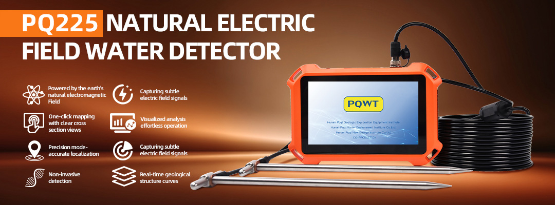
The PQ225 Portable Groundwater Detector with Automatic Mapping is designed for accurate underground water detection and water exploration. Using advanced magnetotelluric field technology, the device analyzes differences in underground conductivity to identify aquifers, fractures, faults, and geological structures with high precision.
This groundwater detector automatically generates real-time mapping and geological profiles with one click, eliminating the need for complex computer processing. The intuitive curve graphs help users quickly understand subsurface conditions and make efficient decisions during drilling and exploration projects.
PRODUCT FEATURES
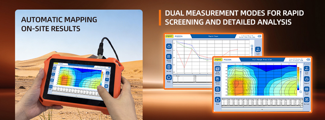
【AUTOMATIC MAPPING, ON-SITE RESULTS】
Without relying on computers for post-processing, the instrument automatically generates geological profiles and curve graphs with one click. Operators can quickly obtain geological structure information on-site. Through smooth data processing, key targets such as aquifers, fractures, faults, and karst caves can be directly analyzed, significantly shortening the exploration cycle. The generated profiles clearly show the position and depth of aquifers, providing an intuitive view of underground geological structures and eliminating the complexity and delay of manual plotting.
【DUAL MEASUREMENT MODES FOR RAPID SCREENING AND DETAILED ANALYSIS】
Exploration Scan Mode: Designed for quick screening of abnormal areas, efficiently identifies potential regions with geological variations, reducing ineffective exploration zones.

? Real-Time Geological Profiles for Instant Analysis
?High Accuracy Detection of Underground Water
? Portable Design for Easy Field Operation
Applications
The PQ225 Automatic Mapping Water Finder is designed for practical use in a wide range of groundwater detection and drilling scenarios.
Agricultural Irrigation Wells
PQ225 helps locate productive aquifers before drilling, supporting efficient well placement and improving water output for farmland irrigation projects.
Industrial and Domestic Water Supply
The instrument is widely used in industrial facilities and residential water supply projects, assisting users in selecting reliable drilling locations and determining suitable drilling depths.
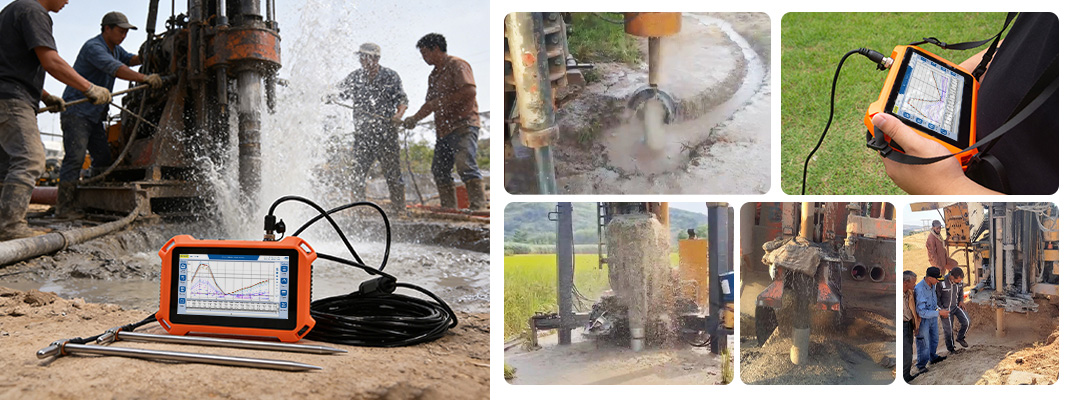
On-Site Drilling Operations
During drilling, PQ225 provides real-time visualization of subsurface structures. Operators can quickly identify aquifers, fracture zones, and fault structures, supporting accurate drilling decisions directly on site.
Field Surveys and Remote Areas
With simple operation and one-click automatic mapping, PQ225 is well suited for fieldwork in rural, remote, and complex terrains, enabling fast surveys and multi-point groundwater investigations without external computers.
PRODUCT COMPOSITION
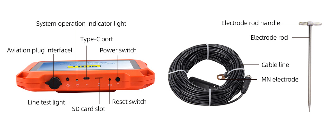
Cable: connects the electrode rod to the host machine.
Technical Specifications
| Parameter | Value | ||||
|---|---|---|---|---|---|
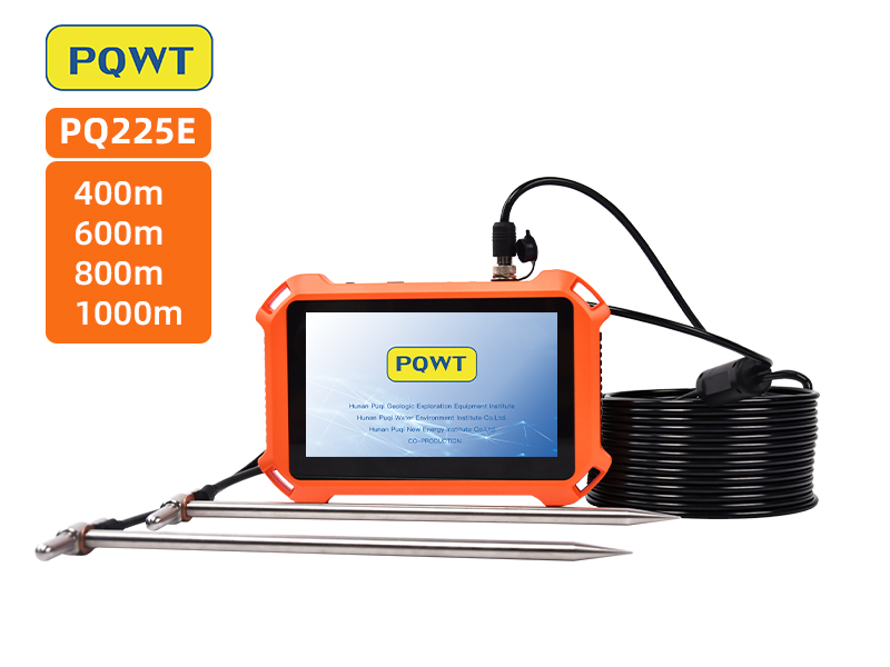
| MODEL | PQ225A | PQ225B | PQ225C | PQ225D | PQ225E |
| OPTIONAL DEPTH | 50m/100m/200m | 100m/200m/400m | 100m/200m/400m/600m | 200m/400m/600m/800m | 200m/400m/600m/800m/1000m |
| MEASURING TIME | ≈45s | ≈60s | ≈85s | ≈90s | ≈100s |
| MEASURING MODE | Scan & Precision | ||||
| GRAPH DISPLAY | Curve, Profile, 3D | ||||
| SIGNAL PROCESSING | Digital Integration | ||||
| FIL TER | FFT Digital Filter | ||||
| NUMBER OF CHANNELS | Single channel | ||||
| A/D CONVERSION | 16 bits 3.6MSPS | ||||
| CONTROLLER | 32-bit high-speed controller | ||||
| MEASUREMENT DATA UNIT | Electric field components of different frequencies of the earth's electromagnetic field E (mV) | ||||
| CHARGING TIME | 6 Hours | ||||
| STANDBY TIME | 6 Hours | ||||
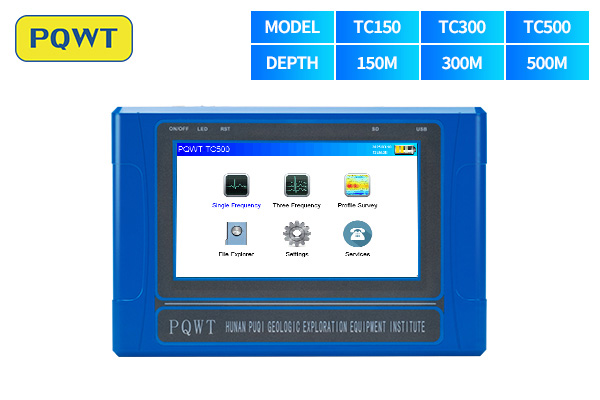
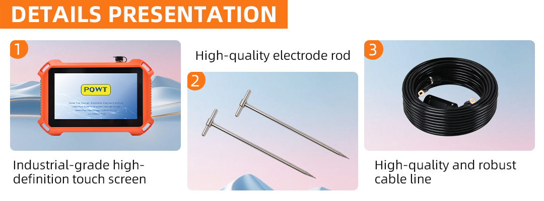
| DISPLAY SCREEN | 7″ Capacitive Touch (1024 ×600 ) | ||||
| BRIGHTNESS | 260cd/m² | ||||
| BATTERY | 3.7 V/7000mAh lithium battery | ||||
| CHARGER | 5 V 2 A | ||||
| INTERFACE | Type-C | ||||
| HOST WEIGHT | 0.6 kg | ||||