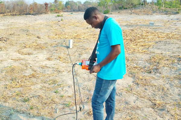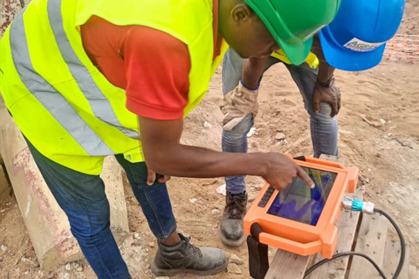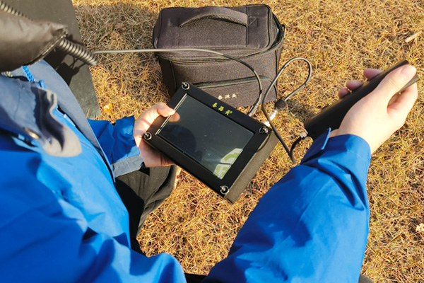

Ground Penetrating Radar (GPR) is a non-destructive geophysical survey method that uses electromagnetic pulses to investigate subsurface structures. It is widely used in civil engineering, underground utility surveys, road inspection, archaeological investigations, and other applications where information about buried features is required.
However, GPR performance is not determined by the equipment alone. Antenna frequency, soil conductivity, moisture content, target characteristics, and data interpretation all influence the quality and depth of detection.
Understanding these factors is essential for engineers and survey professionals who need reliable underground information. This guide explains how GPR works in different ground conditions, how to interpret common radar responses, and what limitations should be considered before a survey.
For more information about radar wave transmission, signal acquisition and data processing, read our guide to GPR working principles and data acquisition
1. How Does Ground Penetrating Radar Work?
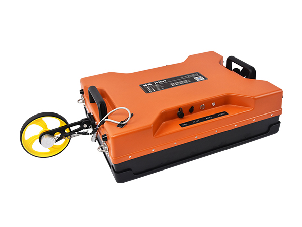
A GPR system transmits short electromagnetic pulses into the ground through an antenna. When the waves encounter a boundary between materials with different electromagnetic properties, part of the transmitted energy may be reflected back toward the receiving antenna.
The system records the returned signals, including their travel time and amplitude. After processing, the data can be displayed as radar profiles that help surveyors identify subsurface interfaces, buried utilities, voids, and other potential anomalies.
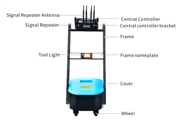
The main components of a typical GPR system include:
Transmitting antenna: Sends electromagnetic pulses into the ground.
Receiving antenna: Captures reflected electromagnetic signals.
Control unit: Coordinates data acquisition and system operation.
Data processing software: Processes radar signals and displays survey profiles.
The interpretation of a radar profile requires an understanding of the ground conditions and the electromagnetic properties of the materials being investigated.
2. How Does Antenna Frequency Affect Detection Depth and Resolution?
Antenna frequency is one of the most important factors when selecting a GPR system. It influences the balance between penetration depth and the ability to distinguish closely spaced underground features.
Higher-Frequency Antennas
Higher-frequency antennas generally provide shorter wavelengths and better resolution for relatively small or shallow targets.
They are often selected for applications such as:
Concrete inspection and structural assessment.
Detection of shallow embedded objects.
Detailed surveys of pavement layers.
Identification of small subsurface features.
However, higher-frequency signals generally experience greater attenuation in many ground materials, which can limit penetration depth.
Lower-Frequency Antennas
Lower-frequency antennas generally provide greater penetration potential but lower resolution compared with higher-frequency systems under comparable conditions.
They may be more suitable for:
Investigating deeper subsurface structures.
Identifying larger underground features.
Geological and geotechnical surveys.
Examining relatively thick soil or rock layers.
The actual penetration depth depends heavily on ground conductivity, moisture, antenna design, target properties, and survey conditions.
Important: A lower-frequency antenna does not guarantee deeper detection in every environment. Site conditions must be evaluated before selecting the equipment.
3. How Do Soil Conditions Affect GPR Performance?
Soil and geological conditions have a direct impact on electromagnetic wave propagation. Even a technically suitable GPR system may produce limited results when the ground is highly conductive or geologically complex.
Soil Electrical Conductivity
Electrical conductivity affects how quickly electromagnetic energy is attenuated as it travels through the ground.
Highly conductive materials, including some clay-rich soils and saline environments, can absorb or attenuate radar signals significantly. This may reduce the effective investigation depth and make underground features more difficult to identify.
In contrast, dry sand, gravel, and some low-conductivity materials may provide more favorable conditions for radar surveys.
Moisture Content
Water content changes the dielectric properties of soil and can influence radar wave velocity and reflection characteristics.
A moisture contrast between two underground materials may produce a detectable reflection. However, high moisture content, particularly when associated with conductive soil, can also increase signal attenuation.
Therefore, wet ground does not automatically indicate that GPR will produce better results.
Geological Layering
Different soil and rock layers may have different dielectric properties. Boundaries between these layers can generate reflections that appear on radar profiles.
Complex geological conditions, multiple interfaces, fractures, and irregular structures may create overlapping reflections, making interpretation more challenging.
For reliable results, surveyors should consider the local geology and, where possible, compare GPR data with borehole records, site drawings, or other investigation results.
4. How to Interpret Common GPR Signals
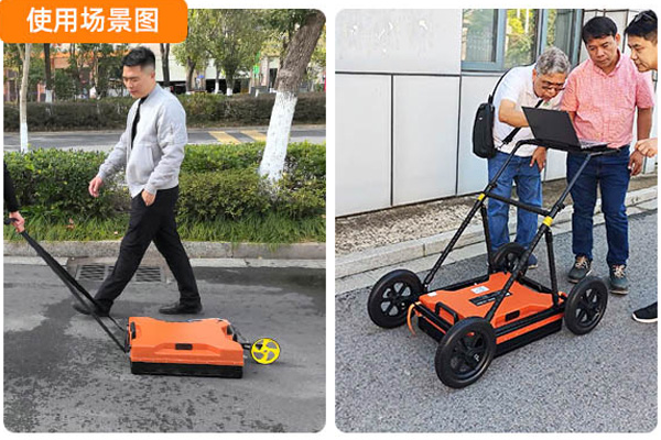
GPR data is commonly displayed as a two-dimensional radar profile. Understanding the shape and continuity of reflected signals helps surveyors identify potential underground features.
Hyperbolic Reflections
A buried object smaller than the effective survey footprint may produce a hyperbolic reflection as the antenna moves across the survey line.
Hyperbolas can be associated with pipes, cables, stones, or other localized underground objects. Their appearance alone does not confirm the material or identity of a target.
Continuous Horizontal Reflections
Relatively continuous reflections may indicate boundaries between different geological layers, pavement interfaces, or other relatively uniform subsurface structures.
The depth and continuity of these reflections can provide useful information about underground layering.
Irregular or Disrupted Reflections
Discontinuous or irregular reflections may be associated with disturbed ground, heterogeneous materials, buried objects, cavities, or changes in subsurface conditions.
Further investigation is normally required to determine the actual cause of these anomalies.
Signal Attenuation
A reduction in signal amplitude with increasing depth may indicate energy loss during propagation. Highly conductive soil, increasing depth, and material absorption can all contribute to attenuation.
Surveyors should distinguish genuine geological changes from limitations caused by signal quality and acquisition conditions.
5. Practical Applications of Ground Penetrating Radar
GPR is used in a range of engineering and geophysical applications. Its suitability depends on the target, required resolution, investigation depth, and ground conditions.
Underground Utility Surveys
GPR can help identify and map buried utilities, including certain metallic and non-metallic pipes, cables, and other underground structures.
It is particularly useful when existing utility drawings are incomplete or when additional information is needed before excavation.
For a broader overview of underground survey scenarios, see ground penetrating radar applications in engineering and infrastructure.
Road and Pavement Inspection
GPR can be used to investigate pavement layers, identify changes in material thickness, and locate certain subsurface anomalies.
This information can support road maintenance, rehabilitation planning, and infrastructure assessment.
Concrete and Structural Inspection
With an appropriate antenna and survey configuration, GPR can help identify embedded reinforcement, conduits, and other internal features in concrete structures.
The results can support structural inspection and help reduce the risk of damaging embedded components during drilling or renovation.
Archaeological and Geological Surveys
GPR can provide information about buried archaeological features, geological boundaries, and shallow subsurface structures without requiring immediate excavation.
Its effectiveness depends on the contrast between the target and surrounding materials, as well as local ground conditions.
6. What Are the Main Limitations of Ground Penetrating Radar?
Although GPR is a valuable non-destructive investigation method, it should not be treated as a universal solution for every underground detection task.
Limited penetration in conductive ground
Clay-rich and saline soils can cause strong electromagnetic attenuation, reducing the effective detection depth.
Interpretation requires technical experience
Different underground objects may generate similar radar responses. Experienced interpretation and supporting site information are important for avoiding incorrect identification.
Detection results depend on survey design
Antenna frequency, survey-line spacing, scanning direction, surface conditions, and data acquisition settings can all affect the results.
Anomalies require verification
A radar reflection indicates a change in subsurface electromagnetic properties, not necessarily a confirmed pipe, cavity, or leak. Important findings should be verified using suitable complementary methods.
Understanding these limitations helps engineers select the right survey method and establish realistic project expectations.
7. How to Prepare for a GPR Survey
Before conducting a GPR investigation, survey teams should collect basic information about the site and define the survey objective.
Recommended preparation includes:
Define the target: Determine whether the project involves utility mapping, pavement inspection, concrete assessment, or geological investigation.
Review site conditions: Collect information about soil type, moisture, groundwater conditions, and surface materials.
Select the antenna frequency: Balance the required resolution against the expected investigation depth.
Plan survey lines: Establish suitable scanning directions, spacing, and coverage.
Calibrate and check the equipment: Confirm that the system is operating correctly before data acquisition.
Interpret and verify results: Compare radar profiles with available drawings, site information, and complementary investigation methods.
A well-designed survey plan can improve data quality and reduce the risk of misinterpreting underground features.
8. Explore PQWT Geophysical Detection Equipment
PQWT develops and manufactures geophysical exploration and underground detection equipment for professional engineering and survey applications.
Its product portfolio includes specialized equipment for different investigation tasks, such as dam leakage detection, underground cavity detection, and other geophysical applications.
The selection of equipment should be based on the actual survey objective, required detection depth, geological conditions, and technical specifications of the instrument.
Explore PQWT geophysical detection equipment to learn more about the available product range.
For application-specific recommendations, contact the PQWT team and provide details about your survey requirements.
Frequently Asked Questions
Q1: What is the main purpose of ground penetrating radar?
GPR is used to investigate underground structures and material boundaries without excavation. Typical applications include utility mapping, concrete inspection, road assessment, archaeological surveys, and shallow geological investigations.
Q2: Does higher GPR frequency provide greater detection depth?
No. Higher-frequency antennas generally provide better resolution but may have less penetration depth. Lower-frequency antennas generally offer greater penetration potential with lower resolution.
Q3: Can GPR work in wet soil?
Yes, GPR can operate in some wet soils. However, high moisture content and electrical conductivity may increase signal attenuation and reduce penetration depth. Results depend on the specific ground conditions.
Q4: Can GPR identify all underground pipes?
No. GPR can detect certain buried pipes and other utilities when suitable electromagnetic contrasts and survey conditions exist. Target identification should be verified with appropriate complementary methods when necessary.
Q5: Is GPR suitable for groundwater exploration?
GPR may provide useful information about shallow subsurface structures and moisture-related contrasts under suitable conditions. However, it is not a universal method for locating deep groundwater resources. The survey method should be selected according to the target depth, geological conditions, and project objectives.
Conclusion
Ground Penetrating Radar is a versatile non-destructive method for investigating underground structures. However, its performance depends on more than antenna specifications.
Frequency selection, soil conductivity, moisture content, geological complexity, and signal interpretation all influence the reliability of survey results.
By understanding these factors and planning surveys according to actual site conditions, engineers and survey professionals can make better use of GPR technology and obtain more meaningful underground information.