
In many regions of Central America, groundwater plays a critical role in supporting local communities, agriculture, and infrastructure development. In parts of Guatemala, surface water resources are unevenly distributed and strongly affected by seasonal rainfall. As a result, groundwater wells remain one of the primary sources of water supply in rural and semi-rural areas.
However, due to complex geological conditions, groundwater exploration in these regions often involves a high level of uncertainty. Blind drilling without sufficient preliminary investigation can lead to increased costs, low success rates, and repeated construction efforts. This has made groundwater survey and site selection an essential step before drilling operations.
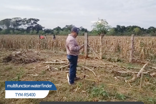
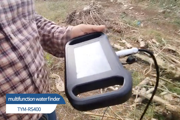
Against this background, the RS400 multifunction water finder was applied in a groundwater survey project in Guatemala, providing technical support for well site selection and drilling planning.
Project Background and Survey Requirements
The project area is characterized by hilly terrain and volcanic rock formations. Subsurface structures vary significantly, with fault zones and weathered layers present in some sections. Previous drilling experiences in nearby areas indicated that relying solely on empirical judgment or historical well data was insufficient to accurately identify new groundwater-bearing zones.
The main requirements of the project included:
Identifying potential groundwater-bearing areas before drilling
Reducing the risk of blind drilling and unnecessary construction costs
Providing reference data for determining drilling locations and depth ranges
After evaluating different survey approaches, the project team decided to introduce a water finder as an auxiliary tool for pre-drilling groundwater investigation.
Field Application of the RS400 Multifunction Water Finder
Before the survey, technicians conducted a basic site assessment, including surface geology observation, terrain analysis, and a review of existing wells in surrounding areas. Based on this information, a survey plan was established, and multiple measurement points were arranged across the target area.
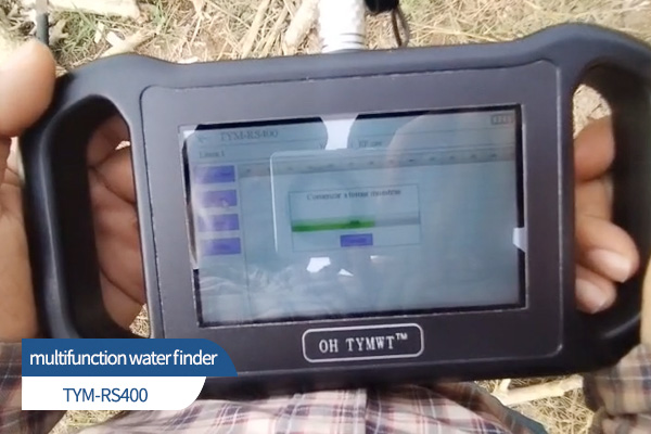
During the field survey, the RS400 multifunction water finder was used to collect data at each measurement point. By comparing data from different locations, technicians analyzed subsurface structural changes and identified areas with a higher probability of groundwater presence. This multi-point survey approach helped reduce local interference and improved the reliability of the interpretation.
After data processing and analysis, a recommended drilling location and an estimated effective depth range were provided to the construction team as reference information.
Drilling Results and Field Verification
Based on the survey results, drilling operations were carried out at the recommended location. As drilling progressed and approached the predicted depth range, clear signs of water inflow were observed. The final well achieved stable water yield, meeting local domestic and agricultural water demands.
From a project perspective, the application of the water finder during the preliminary survey stage helped reduce uncertainty in site selection and improved overall drilling efficiency. It also minimized repeated trial drilling and unnecessary resource consumption.
Value of Water Finder Equipment in Overseas Groundwater Projects
This application in Guatemala demonstrates that multifunction water finders can serve as effective decision-support tools in overseas groundwater projects. Rather than replacing drilling operations, such equipment provides additional subsurface information during the planning stage, helping project teams make more informed decisions.
In regions with complex geology and relatively high drilling costs, preliminary groundwater surveys are especially valuable. Instrument-based data, when combined with field experience, can improve project controllability and reduce operational risks.
Practical Experience from the Project
Several practical insights can be drawn from this project:
Multi-point measurements are recommended in areas with complex geological conditions
Survey data should be interpreted together with on-site geological observations and drilling experience
Proper planning of survey routes and measurement points contributes to more reliable results
These practices are applicable to a wide range of groundwater survey and water well drilling projects.
Conclusion
The groundwater survey project in Guatemala shows that, when applied with proper methodology, water finder equipment can provide meaningful technical support for groundwater exploration. By combining instrument-based surveys with practical field experience, groundwater projects can be carried out in a more systematic and efficient manner.
Although geological conditions vary from region to region, a structured and engineering-oriented approach to groundwater detection is becoming increasingly important in overseas water projects.